Creating flood-resilient communities in the Hunter Valley with FLASH

Project facts
- ClientNSW Department of Climate Change, Energy, the Environment and Water (DCCEEW)
- ChallengeTo upgrade flash flood warning system to accurately predict flooding events and provide more timely alerts, giving emergency response teams enough time to act.
- Period2021-2023
- SolutionImplemented the FLASH system and provided ongoing support to enable flood-resilience among Hunter Valley communities.
- LocationNewcastle, New South Wales, Australia
The challenge: updating traditional flood warning systems
The Hunter Valley is a famous wine-producing region north of Sydney. The Hunter River running through it has a catchment area covering more than 21,000 km2.
To keep communities safe, the NSW Department of Climate Change, Energy, the Environment and Water (DCCEEW) manages the Hunter Valley Flood Mitigation Scheme (HVFMS): an extensive network of integrated levees, floodgates, and drains controlling the river’s large flood plain.
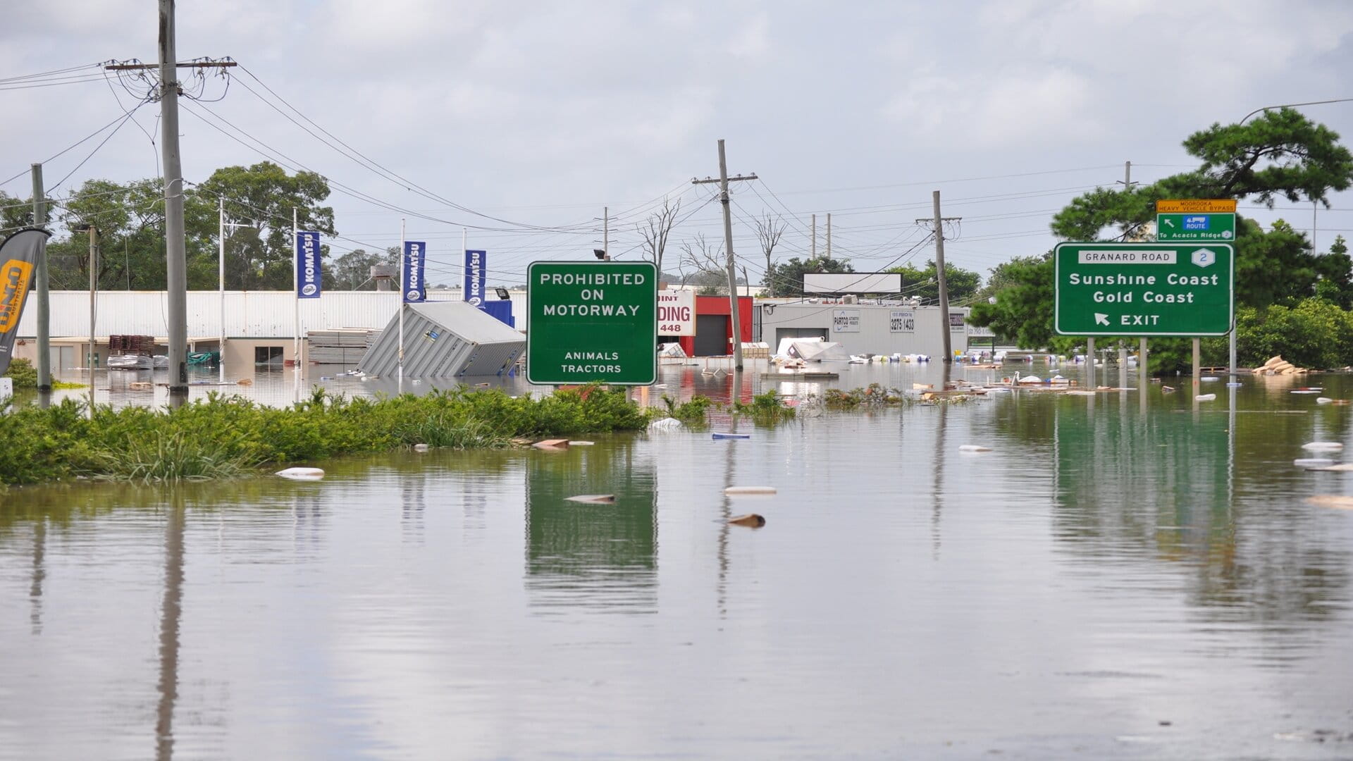
However, the network’s operation relied on using the historical knowledge of specific individuals to interpret forecasts from Australia’s Bureau of Meteorology (BoM). This made the system vulnerable. In March 2021, the region was impacted by a significant flood event, highlighting the need to improve and update the existing approach.
With the wider operations team unable to reliably predict which areas would be affected by flooding, or how badly, emergency response teams had limited time to act. Areas affected included the Pacific Highway, the main road connecting Sydney and Newcastle to the north of the state.
To protect citizens, assets, and businesses better while enabling local communities to become flood-resilient, the DCCEEW asked for our help.
FLASH has been a valuable emergency response tool, which we have relied on during recent flooding events. Not only did it assist the HVFMS team in its proactive incident management, but it was also used by the HVFMS team to assist first responders and local government authorities in their respective emergency responses.
The solution: fast, accurate, and reliable flood prediction and warning
We evaluated the DCCEEW’s existing approach, assessing the impacts of levee failures, and developing protocols for flood forecasting and mapping.
We created a system that captured all the historical expert knowledge held by individuals in an online system so it was accessible by other members of the operations team. Then we incorporated that into a flood warning system.
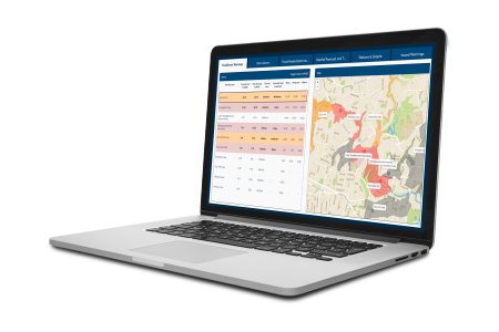
By January 2022, we had developed a flood information system for the HVFMS covering the entire Hunter River catchment area and its tributaries. It uses our cloud-based FLASH service, which combines historic rainfall and water level data with short and long-term BoM forecasts to build a sophisticated hydrodynamic flood model.
These forecasting metrics, such as flood levels and depths, are visualised in a user-friendly dashboard. Flood warnings with color-coded impacts (based on local knowledge, past events, and plans) are sent out via e-mail or text to emergency response teams.
The result: flood-resilient communities
The new system was put to the test as soon as July 2022, when the catchment was hit by a large flood event, comparable to:
- a 10% AEP (annual exceedance probability) event on the Hunter River, around Maitland,
- over a 1% AEP event on Wallis Creek, at Louth Park,
- over a 0.2% AEP event on Wollombi Brook.
FLASH sent out warnings to DCCEEW staff about which levees were close to overtopping. Working with other government agencies, including Transport for NSW and NSW State Emergency Service, the DCCEEW informed local councils about the potential impacts and advised on mitigation tactics.
FLASH enabled the DCCEEW to accurately predict where, when, and to what extent flooding was going to occur in the catchment area, then respond and mitigate its impacts. It could predict its effect on major traffic routes like the Pacific Highway and action timely road closures.
Using operational modelling, the system also helped with post-flood recovery by estimating when critical infrastructure would be functioning again as the floodplains draw down.
As a result of FLASH, the HVFMS team can make more informed decisions and act quicker. It has also improved operational efficiency while making the team more resilient to any staff changes.
Find out yourself
Want to know moreor got a question?
Contact our Climate Resilience experts!