Flash flooding and heatwaves: Can you model the risks?

Although extreme weather events are increasingly frequent, flood models often underestimate the risk of flash flooding after high temperatures.
Author: Mark Frost, Senior Business Development Professional, Climate Resilience
Last summer’s intense heatwave ended with thunderstorms and flash flooding. During summer 2022, intense heatwaves saw much of Europe reach record-breaking temperatures (the UK hit 40°C for the first time). Severe droughts led to dry ground, reservoirs running empty and hosepipe bans, and there was an obvious need for rain to recharge depleted water stocks. However, when the heatwaves finally ended, the UK (and other parts of Europe) were subjected to another form of extreme weather: thunderstorms and flash flooding.
And in May 2023, heavy rain – again following months of drought – led to extensive flooding across north-east Italy. Causing over 20 rivers to burst their banks and triggering hundreds of landslides, the flooding displaced around 40,000 people.
While they’re often localised, periods of intense rainfall can be very costly, especially when a prolonged spell of hot, dry weather precedes them.
Why is the combination of heatwave and flash flooding particularly damaging?
Essentially, the lack of precipitation – along with unusually high temperatures – hardens the ground, reducing the soil’s infiltration capacity. And when there’s heavy rainfall, previously permeable surfaces become impermeable, leading to increased surface water runoff and flash flooding.To mitigate costs from flash flooding, businesses need an accurate view of pluvial flood risk for their properties and infrastructure.
But how do you get that understanding? And what else should you do to prepare for and mitigate the impact of flash floods as the climate crisis intensifies?

Flood modelling is vital – but can it accurately identify flash flood risk?
Twinn has conducted extensive research into flood modelling. And while modelling is, of course, essential to identifying risk, it’s worth remembering the following:
-
Standard models may underestimate the risk of flash flooding following a heatwave
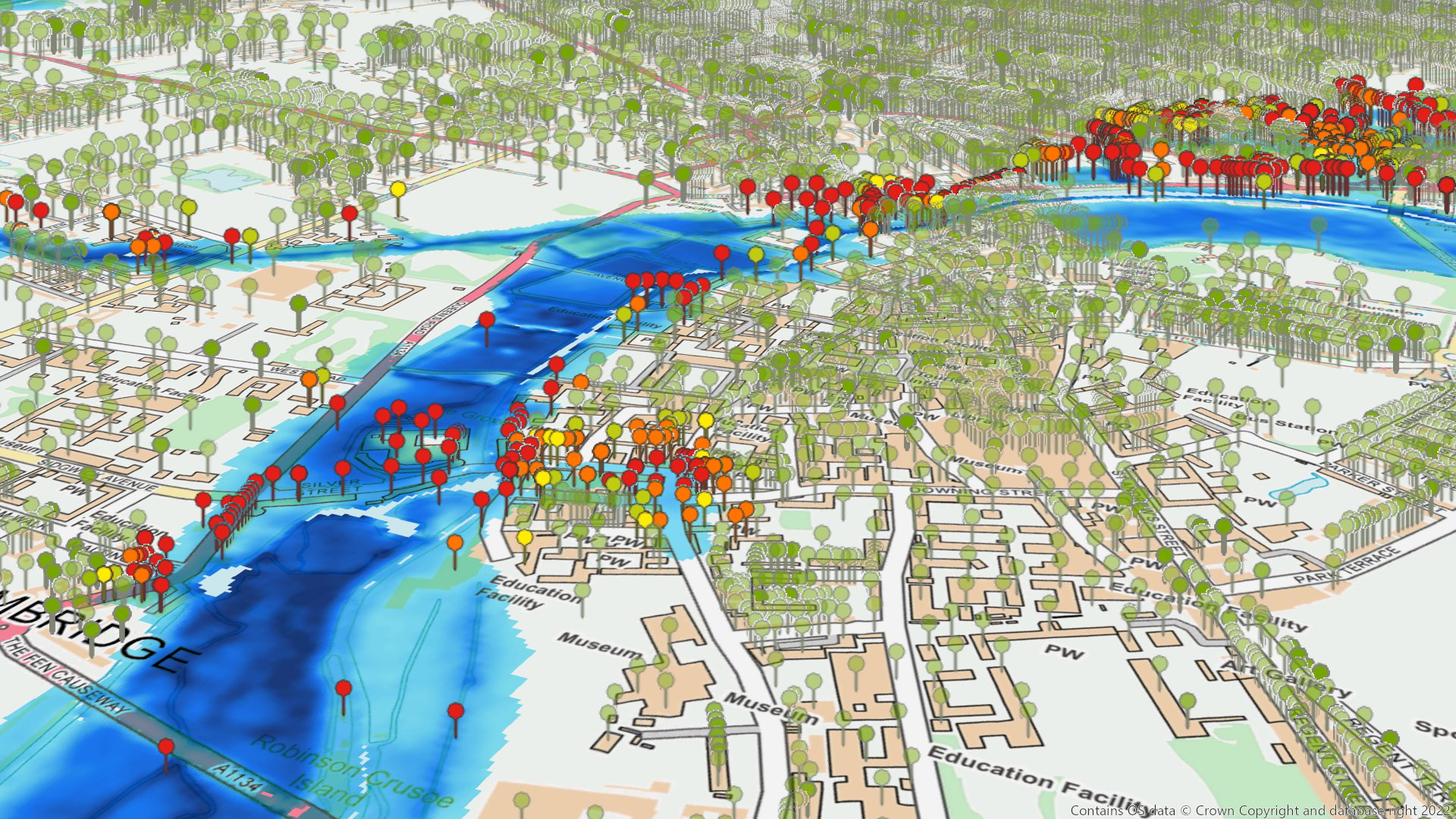
Within models, ground surfaces are parameterised on their infiltration capacity: fields can absorb more water than concrete, for example. Under normal conditions, these parameters accurately reflect water absorption rates. However, dry ground conditions make most surfaces impermeable. As a result, following a heat wave, surface water flooding is likely to occur in places not modelled to be at risk (and the magnitude of risk is higher).
However, by utilising high-resolution LiDAR topographic data, you can identify ground surface features. It’s then possible to define flow paths and potential pluvial flood risk. -
There are multiple methods of assessing a location’s flood risk
Different approaches to correlating flood hazard to building exposure have distinct strengths and weaknesses, especially when it comes to understanding pluvial flood risk. -
The Environment Agency’s national pluvial hazard map provides a good overview of flash flooding risks
But consider combining this with another model view to get a more accurate picture of the flash flooding risk for specific addresses and site locations.
How do you prepare for and mitigate the impact of flash flooding?
Your flood models must be fit for purpose. This involves incorporating the most accurate input datasets and constantly validating and refining the models.Twinn Climate Risk Analytics (formerly under the Ambiental brand) provides climate risk intelligence that encompasses 19 hazards, including pluvial floods. Helping you visualise risks and identify hazards before they impact your business, our risk management platform delivers solutions that help you become climate resilient.
And by providing high-granularity flood data (and leveraging LiDAR data) we enable large area searches, risk visualisation and metadata investigations – helping corporate insurers, reinsurers and utility companies plan effectively. Moreover, we’ve conducted extensive research into claims and model validation, along with how past experiences can be used to refine underwriting strategies and guidelines.
Are you worried your existing flood models aren’t providing a full view?
Would you like an in-depth discussion on model parametrisation? Maybe you’re looking for an independent assessment of your pluvial flood risk or a claims evaluation post-event?Get in touch to find out more about how Twinn can help you better understand the risks from flash flooding.
